The digital recording of cemetery data is playing an increasingly important role in modern cemetery management. But which method is the best? Technical possibilities, costs and individual requirements must be carefully weighed up. This article provides an overview of seven proven methods and shows which technology is best suited to which situations.
Why choosing the right data capture method is crucial
Every digitization project starts with a central question: What is the data needed for? Depending on the objective – whether for occupancy plans, infrastructure measures or a completely new concept – the right collection method can be selected. The higher the required accuracy, the higher the costs.
Classification of the recording methods

In practice, seven main recording methods are used:
- Measuring with a tape measure
- Digitization from orthophotos
- total station surveys
- laser scanning
- Drone surveying
- Combination of drone and total station surveying
- Combination of orthophotos and total station surveying
The choice of method depends on various factors, including cost, accuracy and local conditions. Figure 1 shows the methods with regard to these criteria. Methods with high costs and low accuracy (red quadrant) should be avoided, while methods with good accuracy and moderate costs should be avoided.
Comparison of the different measuring methods
- measuring with a tape measure – simple but impractical
Manual measuring with a tape measure is suitable for small spot measurements, but not for a comprehensive cemetery survey. Due to the high susceptibility to errors and the time required, this method is in the red quadrant.
- digitization from orthophotos – cost-effective solution with limitations
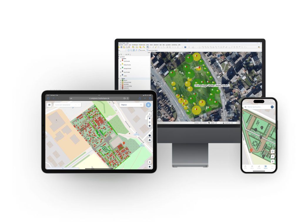
Digitization in the GIS
Orthophotos are true-to-scale, georeferenced aerial images with a resolution of 10-30 cm. They offer an inexpensive way of converting cemetery areas into GIS1 or CAD2 plans. However, obstacles such as dense tree cover can affect the accuracy. In such cases, supplementary measurement methods can provide a remedy. It is also possible to create the graves in shaded areas by construction.
- total station survey – precise but time-consuming
Total station surveying is one of the most accurate methods and is often used in road or sewer construction. Each measuring point is recorded exactly on site, but this is time-consuming and costly. This method is particularly useful for small cemeteries or selective construction measures (e.g. stairways).
- laser scanning – detailed point clouds for complex structures
Laser scanning uses rotating laser beams to generate three-dimensional point clouds that provide an exact digital model of the cemetery. This method is particularly suitable for new designs or cemeteries with many architectural elements or high point densities. This method is one of the more cost-intensive procedures.
- drone surveying – efficient for large areas
Drones can be equipped with GNSS3 sensors to precisely measure large areas from the air. This method is particularly suitable for area balances, occupancy plans or new construction projects. However, trees or tall buildings can interfere with the measurements.
6 & 7 Hybrid methods – combination for optimum results
The disadvantages of individual methods can be compensated for by intelligent combinations. For example, a drone survey can be supplemented with a total station survey to enable both large-area coverage and detailed precision measurement.
Conclusion – the right method for the right purpose
There is no universal solution – every cemetery has individual requirements. The aim should be to choose the method that comes closest to the green quadrant. In addition to accuracy and costs, local conditions such as tree population or buildings also play a decisive role.
The digitization of cemetery management offers enormous advantages – from more efficient work processes to improved documentation. A well thought-out choice of recording method is the first step on the way to sustainable, digital cemetery management.
1 Geographic information system
2 Computer-aided design, construction program
3 Global navigation satellite system (e.g. GPS)
Source: 01.04.2025, PBSGEO GmbH, Friedhofskultur