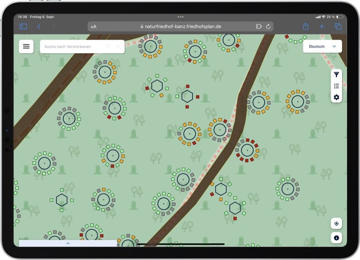
Many visitors to cemeteries are familiar with the situation: despite good orientation, they find it difficult to locate the graves of their loved ones in the cemetery. To solve this problem, PBSGEO GmbH from Cologne has developed an innovative navigation system for cemeteries. The cemetery software not only simplifies the work of cemetery administrations and trades, but also improves the visitor experience. Find out below how a digital cemetery map provides a better overview of the Banz natural cemetery.
By law, cemetery owners are legal entities under public law, usually municipalities or churches. Their day-to-day work is characterized by regular consultations and intensive discussions with various stakeholders in order to coordinate the many different tasks. In doing so, they face numerous challenges: Managing the cemetery areas, complying with legal regulations and documenting burial plans are not only costly and time-consuming, but also require a high degree of overview and coordination. Traditional methods such as handwritten plans or outdated software quickly reach their limits, particularly in larger cemeteries, especially woodland cemeteries. “A digital cemetery plan offers a modern solution here,” emphasizes Stefan Schumacher from PBSGEO GmbH. “It considerably simplifies the work of the cemetery operators by centrally recording and clearly displaying all relevant data.”

“Whether it’s locating gravesites, planning new burial areas, marketing graves or billing burial fees – the challenges can be made noticeably more efficient through the use of digital technologies,” continues the expert. “This not only saves cemetery operators time, but also ensures that their administration meets the requirements of a modern cemetery.” For this reason, PBSGEO GmbH has developed a solution that supports operators of forest cemeteries and privately organized cemeteries. As a leading expert, innovation driver and sought-after contact for cemetery digitization, the company helps public, private and church institutions and organizations to create a digital image of their cemeteries. Because all users can then access the data with any end device, regardless of location and time, this creates great added value for cemetery administrations, the trades working in the cemetery and visitors.
Digital cemetery management as a solution for everyone involved
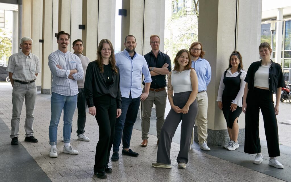
“Our PBSGEO software for forest cemeteries offers a modern solution for managing and using cemetery data,” says Stefan Schumacher. “Information can be shared easily and centrally – whether with trades, external service providers or visitors. This not only increases the service quality of the cemetery operator, but also significantly reduces the workload of employees.” Visitors can easily scan a QR code and immediately use the online grave search. It is also possible to create memorial pages with historical information on individual graves. Together with his team, Stefan Schumacher has already digitized more than three million graves for over 200 customers worldwide – including many large cities and administrations in Germany, Europe and South America.
Digital cemetery using the example of the Banz natural cemetery
One example of how PBSGEO GmbH can help with its cemetery program is the joint project of the Banz natural cemetery in the Upper Franconian district of Lichtenfels. It took seven years from the idea to implementation. In 2023, the Ducal Forestry Administration Banz then opened a natural cemetery that is unique in this form in the region. The cemetery is run by the town of Bad Staffelstein. A digital exchange was desired and required from the outset, which is why PBSGEO GmbH developed a digital cemetery plan for the Banz natural cemetery that is precisely tailored to its requirements. The plan is appreciated by the operators and citizens alike.
The digital cemetery map helps visitors to find their way around the extensive woodland grounds, where the deceased are laid to rest amidst oak trees and sandstone boulders. With currently 2,800 grave spaces, both single graves and partner graves as well as family graves can be reserved. The plan also makes it possible to conveniently manage grave usage rights and the resting period online. The option for visitors to select a grave directly on site and reserve it easily via their smartphone is particularly practical. “Cemetery management can be handled very well with our PBSGEO software for forest cemeteries,” reports Stefan Schumacher. “The digital cemetery plan has also been online since the opening, which reduces the administrative workload for the cemetery administration and improves the service for citizens.” In the future, there are plans to further optimize reservations so that interested parties can not only reserve graves, but also pay for them directly online.
Another advantage of the cemetery software is that the desired tasks can be easily forwarded to the forestry staff who work as service providers for the Banz natural cemetery. The employees can call up all tasks directly from their smartphones and mark them as completed when they are finished. The solution from PBSGEO GmbH ensures that everyone involved – from the administration to the visitors – can access all the necessary information at any time and from any location.
This is how cemetery software simplifies the entire working day
It should be noted that the decision to digitize a cemetery has numerous advantages. The software solution from PBSGEO GmbH is not only used to manage the cemeteries, but also as an efficient task management system with location links that simplifies communication between office staff and field staff. The integrated tool precisely describes tasks with coordinates, photos and priorities so that every employee knows exactly what needs to be done where and when. The application is so intuitive to use that no training is required. “Cemeteries are more than just places of mourning,” concludes Stefan Schumacher. “They are always also points of concentration in the history of a city. Our aim is to make cemeteries more accessible and easier to experience in order to give them a new meaning.”
As a public, church or private institution or organization, would you like to benefit from the many advantages of the digital cemetery? Contact Stefan Schumacher from PBSGEO GmbH (https://www.pbsgeo.com) now and find out more! You can find the cemetery map of the Banz natural cemetery at: https://naturfriedhof-banz.friedhofsplan.de/
Source: Süddeutsche Zeitung, 16.01.2025, https://pressemitteilungen.sueddeutsche.de/pbsgeo-gmbh-5950275


