The example of the municipality of Montabaur shows how cemetery administrations can use digital cemetery plans to tell and illustrate regional history on site.

In August 2020, the Cologne-based company PBSGEO was awarded the contract to create digital cemetery plans for the municipality of Montabaur in Rhineland-Palatinate. In the data acquisition process, grave data from over 300 paper plans from 31 cemeteries was transferred to the cemetery cadastre and linked to the elFRIED program from CTS. After the initial entry, the municipal administration checked the grave data and added additional information on significant graves, monuments and cemetery chapels.
The publication
Once the recording work had been completed, the digital cemetery map was released to the public. In addition to the link from the municipality’s website, QR codes were posted at the cemeteries. These can be scanned with a smartphone or tablet. The cemetery map of the respective cemetery then opens on the mobile device. Markus Kuch, Head of Environment, Cemeteries and Building Yards at the municipal administration, reports that the digital cemetery map makes communication with the trades working at the cemetery much easier. This increases the service quality of the cemetery administration while at the same time streamlining work processes.
The Volkstrauertag working group
The Westerwälder Zeitung newspaper, for example, reported on the publication of the digital cemetery map. As a result, Claus Peter Beuttenmüller, Director of Studies (retired) of the Landesmusikgymnasium Rheinland-Pfalz in Montabaur, became aware of the digital cemetery map. Mr. Beuttenmüller headed the Volkstrauertag working group for 20 years, which emerged from a history competition organized by the Federal President in 2002. The working group set itself the task of processing the fates of fallen soldiers who were buried in the Westerwald cemetery in terms of cultural history. According to Beuttenmüller, there are over 1,000 dead, most of whom found their final resting place at the cemetery in Montabaur, far from their homeland. In most cases, nothing was known about the deceased apart from their names and dates of death, which were engraved on the small gravestones.
As part of the competition, interested students sought more individual information about individual soldiers, their families, their lives in the politicized society of the German Reich and, finally, about their deaths, in order to show that here lies a person “like you and me”, torn from an unfinished life by violence.
The work in archives and the contact with relatives actually made it possible to understand a number of fallen soldiers as human beings beyond their status as soldiers.
Beuttenmüller saw the digital cemetery map of the municipality as an opportunity to make the researched information on the fallen of the Second World War digitally available to a larger group of people and to secure it permanently.

The implementation
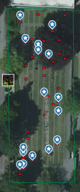
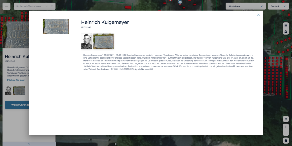
The information compiled by the Volkstrauertag working group on the stories and fates of the fallen soldiers was handed over to the cemetery administration and deposited at the assigned graves. These can now be accessed online, whether on site at the cemetery or from home.
Conclusion
The digitization of cemeteries not only makes it possible to optimize cemetery administration. It is also a suitable means of tracing regional history through the fates and lives of the deceased.
Source: Friedhofskultur, January 2023


