Thanks to friedhofsplan.de, the cemetery administration of Technische Betriebe Offenburg was able to relaunch its cemetery map and, since April, has enabled citizens and visitors to search for deceased persons and graves quickly and easily. What are your experiences with the digital plan in practice?

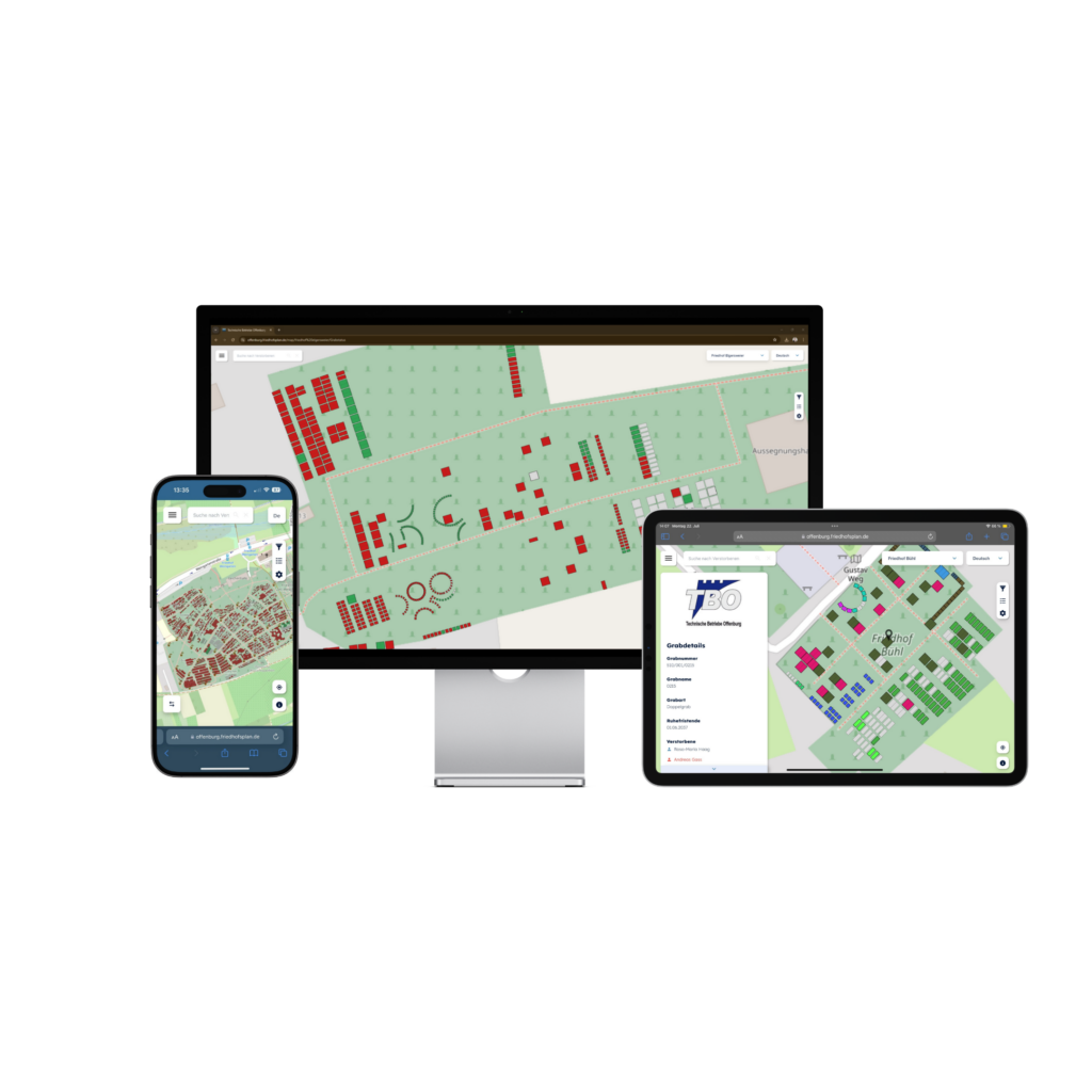
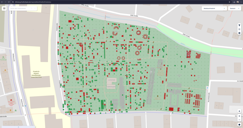
The cemetery administration of Technische Betriebe Offenburg is offering its visitors a new digital service: a convenient online search for gravesites. “Thanks to our innovative collaboration with PBSGEO GmbH from Cologne, users can now use their smartphones to quickly and easily find the gravesites they are looking for,” explains Hans-Jürgen Jäger, head of the Offenburg cemeteries department. “Instead of laboriously searching through the many graves, the new platform offers a virtual tour of each of our 13 Offenburg cemeteries.” It is very easy for visitors to use. “After selecting the desired cemetery, the screen shows an overview of the entire site. You can search for a specific grave by entering the family name. The platform then shows all the people with this surname who are buried in the selected cemetery. By selecting a name from the list, the grave site is displayed on the overview map,” says Jäger, explaining the procedure.
Visitors who are on site at the cemetery can use a smartphone to call up their location via GPS signal to help them find their way around. The color coding on the map shows which grave is occupied (red), still available (green) or already levelled (grey). However, Jäger points out that it is only possible to search in the cemetery where the visitor is currently logged in. It is not possible to search from the basic mask of the city cemetery to a district cemetery, for example. It is therefore necessary to know the exact cemetery in order to search.
Data security is an important issue for the citizens of Offenburg. Jäger emphasizes that data protection is maintained with digital grave information. “After all, the names of the deceased are also written on the gravestones, which anyone can read.” However, graves can also be anonymized if required.
“The digital cemetery map not only makes work much easier for our visitors, but also for our cemetery administration. Communication with the trades working in the cemeteries, such as morticians, stonemasons and gardeners, has become much easier with the digital cemetery map,” says Jäger. The topic was advertised in the press in advance and there was a lot of positive feedback. “The previous tedious manual entry of graves on huge paper plans is now a thing of the past. Changes such as the leveling of old graves or the creation of new ones previously had to be manually crossed out, corrected or re-entered on the plans.
The preparations for the initial creation of the digital cemetery plan meant extra work for our administration,” explains Jäger. But today, a mouse click is often enough to create digital links or retrieve information. The entire team in Offenburg is pleased with the simplifications. The program also provides valuable information about upcoming changes to the gravesites, which enables early planning. The digital cemetery plan can therefore streamline administrative tasks. Phone calls with citizens looking for a grave site are largely eliminated.
To make it easier to use the digital cemetery map on site, signs with a QR code will soon replace the paper map in the display case, from which the QR code previously had to be photographed. There are also plans to collaborate with the Historical Society in Offenburg to provide citizens with additional information on historical graves.