
PBSGEO presents its friedhofsplan.com platform, a key tool for the modernization of processes.

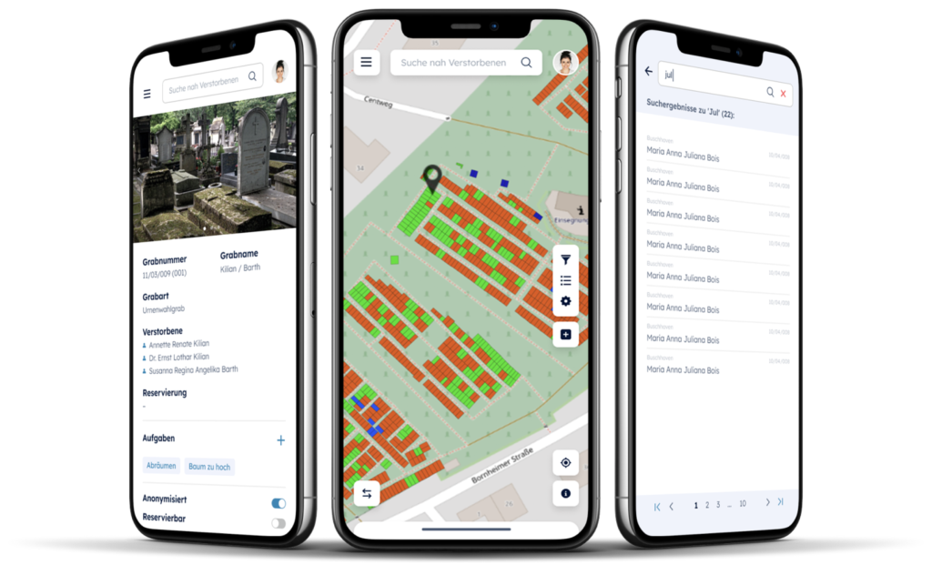
The German company PBSGEO, headquartered in Cologne, unveils in our country the platform friedhofsplan.com, which leads the digitization of cemeteries in Germany. The application can be integrated to all relevant cemetery databases, achieving an encrypted and automated synchronization of these in the background. friedhofsplan.com is accessible from any device with Internet connection (PC, laptop, tablets, mobiles…), being able to consult any type of information online.
Information online
The new digital tool not only facilitates the management and internal administration of the cemetery, but also makes it possible to share data with other professionals in the sector such as funeral companies or can be a useful consultation channel for citizens. A QR code at the entrance of the cemetery facilitates access to the digital map, providing convenience and ease of use for both the visitor and any professional who comes to the cemetery.
Increased Efficiency and Quality of Service
The search function simplifies the localization of graves by displaying the user’s position using the GPS signal of the device. “Administrations that rely on friedhofsplan.com report a significant reduction in calls requesting information about grave locations, which improves the efficiency and quality of the service,” says PBSGEO.
PBSGEO reports a noticeable decline in inquiries about grave locations, enhancing both efficiency and service quality. The system also allows for online task assignments to companies such as funeral directors and other service providers, reducing administrative efforts and facilitating the implementation of automated processes. Additionally, friedhofsplan.com structures the various tasks within cemeteries and improves communication and coordination between different administrative areas. Field staff receive task notifications on their devices, and photos taken are immediately integrated into the cemetery map or linked with the corresponding graves.
Source: Revista Funeraria
Click here for the original article: Revista Funeraria